
Ohio County Property Search: From Address to Parcel
Start with the county Assessor. Do this when your clue is a street address or a person who may own land. The office returns a parcel card. That card lists separate street and mailing addresses, the tax district, the map/parcel key, and a deed book and page reference. Each field points toward a different next source. An address alone can be ambiguous. An owner name may belong to a trust. It may belong to a company, an estate, or one of many people with the same name. The parcel identifier is the cross-check that keeps the property records straight.
- Search the Assessor by parcel address, or use owner name in LAST NAME FIRST NAME order without a comma.
- Copy the district, map/parcel, account number, legal description and deed book/page from the card.
- Use the Clerk's Document Inquiry for a newer instrument or the Vault index for an older book reference.
- Compare the parcel in the WV Property Viewer, then check the Sheriff tax ticket if the question concerns a bill.
- Ask the Clerk for a copy or in-person help when an image, index book or exhibit is not available online.
This route runs source by source rather than through one statewide database. Note the date you searched and the exact parcel key. A name-only match can join records that belong to different people or tracts.
Search Fields on the Ohio County Assessor Form
The Ohio County form accepts several independent keys. Begin with your strongest clue, then add a second field only if the first property search returns too many parcels. Field names matter here, because an account number, a legal description, and a map/parcel key are different identifiers in the county's property records.
| Assessor field | What to enter | Useful when |
|---|---|---|
| Owner Name | LAST NAME FIRST NAME, no comma | Address is unknown or a name needs to be compared. |
| Parcel Address | Physical or situs address | Beginning with a house or building location. |
| Account # | County account identifier | A bill or older card includes this number. |
| District and Map/Parcel | Tax district plus map and parcel parts | Matching a tax ticket, map result or Clerk instruction. |
| Property Type | Choose a listed category | Narrowing a broad name search. |
| Legal Description | Subdivision, tract or text clue | Rural land or an address that changed. |
| Deed Book/Page | Paired recorded reference | Cross-checking an instrument cited on a card. |
The form takes combinations and does not demand a complete entry. The county says the basic search is free and needs no login. A building-record link may ask for one. Keep that feature separate from the public parcel lookup. The Assessor publishes no online cutoff date for the roll on its landing page. The official page shows the full field list: Ohio County Assessor Property Record Search.
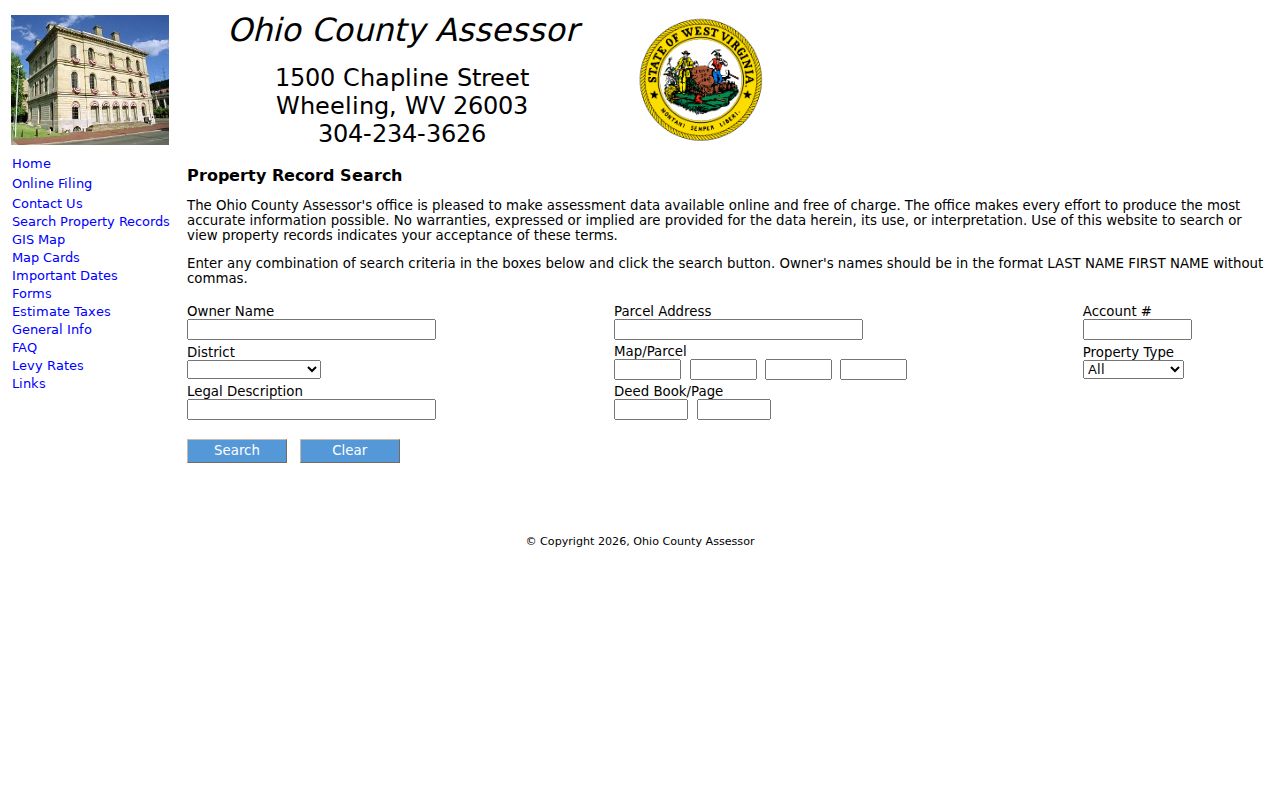
Use that field list to translate a paper ticket or deed reference into the identifiers the online parcel card understands.
What an Ohio County Parcel Card Returns
A search result reads best when its fields are treated as separate clues. The Assessor card lists the current owner, mailing and street addresses, tax district and map/parcel, an account number, a legal description, deed book/page, sales history, and assessment information. Property factors may appear too, along with map or building-record links where enabled. Each item answers a different question about the parcel.
| Current Owner | Tax-roll owner name; the Clerk warns it may not be regularly updated. |
|---|---|
| Mailing Address | Where tax correspondence is directed, not necessarily the property's location. |
| Street Address | Situs location used to identify the building or tract. |
| District, Map/Parcel, Account | Keys that help compare assessor, map and tax records. |
| Legal Description | Text describing the tract, lot or subdivision interest. |
| Deed Book/Page and Sales History | Recorded reference and reported sale-history clues to verify at the Clerk. |
| Assessment Record | Tax-roll value information, not a sale appraisal. |
Keep the card inventory straight during a property search. The owner name tells you who the tax roll lists. The situs tells you which place is being assessed. The deed book and page points toward the recorded instrument. No card summary replaces the document itself, its exhibits, or a full title search.
Read an Ohio County Search Result as a Set of Clues
Each system answers a different question. The Assessor card gives the tax-roll identity and a bridge to other records. A Clerk result gives a recorded party, role, instrument type, date, and document reference. The map returns geometry and a GIS ID. Keep those result types distinct even when they repeat the same name or address.
| Owner of Record | Current Owner tax-roll name; confirm with the latest deed. |
|---|---|
| Situs / Mailing Address | Property location and separate tax-mail destination. |
| Parcel Number | District, map and parcel components used to match local records. |
| Assessment | County tax-roll value fields, not a market appraisal. |
| Legal Description | Lot, subdivision or tract wording to compare with the deed. |
| Last Sale | Sales-history clue to cross-check with the Clerk instrument. |
A web result certifies nothing by itself. It cannot show clear title, reveal every unrecorded claim, or settle a surveyed boundary. It may even list a former owner after a transfer. Treat it as an index into the official file. Check the underlying record whenever the question carries legal or financial weight.
Ohio County Clerk Search Has a 1993 Cutover
Document Inquiry reaches recordings from January 1, 1993 forward. Search a party surname and first name, pick a party role and a document index or type, then use the result reference to open the public image when one is available. The Clerk lists roles including grantor, grantee, creditor, and decedent, with indexes for Deeds, Liens, Estates, and Oil & Gas Leases among others. Names and summaries update as soon as an instrument is recorded. The image generally appears about 28 business hours later. If a card's deed reference predates the cutover, choose the Vault, select a book type, and enter the book and page. When the reference is unknown, the historical indexes cover 1777-1935, 1936-1959, and 1960-1992 in separate Grantor and Grantee books. Corporations and firms have their own index. The Clerk's Find a Deed guide explains the card-to-document handoff, though any book/page or party match should still be checked against the full description and exhibits.
Use WV Assessment for a Prior-Ownership Lead
WV Property Assessment offers statewide search modes and value filters, including a prior-ownership mode. That gives a second route when a name or historical assessment clue helps. The landing page states no search cutoff. So never assume a result reaches a particular year without reading the displayed record. Carry the district, map/parcel, and deed reference from the local Assessor card into any county-level search. The statewide assessment record is not the Clerk's instrument. It does not prove a conveyance was recorded. The county tax roll and the Clerk remain the right sources for those separate questions. WV's assessment site describes its search route: WV Property Assessment.
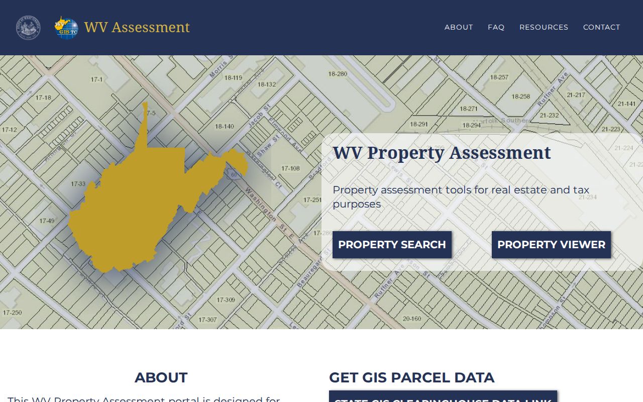
Compare any result to a county parcel key before treating it as the same property.
A Wheeling Property Search May Need the 1873 Street Crosswalk
Wheeling renumbered its streets and addresses on July 11, 1873. That single change trips up many searches. A deed or directory entry may carry an older label. It will not surface under a modern street query. The Ohio County Public Library's old/new street-name handout links the two eras of labels together. Its directories and maps help too. Find a candidate lot through the crosswalk first. Then confirm it against the Assessor's parcel and the Clerk's legal description before trusting the match.
One caution applies to directories. They list occupants, businesses and addresses, not guaranteed owners of record. Treat a directory name as a lead rather than proof. Let a reverse-street directory carry you from street and number to occupant. Only a deed chain establishes who actually received title.
Choose the Right Ohio County Property Search Key
Each search key has its place. An address gets you to a building fast. An owner name can turn up more than one parcel card. A district, map, and parcel combination gives the tightest match once you have it. The best choice hinges on how the source describes the land: a rural tract or an older deed may carry a legal description with no street number at all, while an urban lot may show a present situs that differs from its pre-1873 address.
| Search Key | Best For | Where It Works | Watch Out |
|---|---|---|---|
| Address | Locate one home, site or tract | Assessor and WV Property Viewer | Historic names, postal labels and city lines can differ. |
| Owner name | Find parcels tied to a person or entity | Assessor and Clerk indexes | Try name order and entity variants; common names create false matches. |
| District/map/parcel | Match a known county tax parcel | Assessor, Sheriff and Viewer | Keep district and parcel parts together. |
On the Assessor form, type an owner name as LAST NAME FIRST NAME with no comma. Start narrow. Use the address when the street location is known. Use district/map/parcel when an older tax bill supplies those identifiers. Businesses and trusts may be indexed under a recorded entity name. Try the exact spelling from a deed instead of a guessed personal name.
Never swap one number for another. The account number identifies an Assessor record. District, map, parcel and any sub-parcel describe the tax-map key. A deed book and page point to a specific instrument in the Clerk system. When several parcels share a street number, keep the result card's legal description and situs together. This keeps the right record attached. The basic property card is free to search and needs no login. Some building detail may prompt for one.
A correct name can still point to the wrong property. Before opening deed history, compare mailing address, physical address, property type and legal description. A property card is a search aid only. It does not settle whether the current tax-roll name is the latest deed grantee.
Once the right card appears, save its account number and district/map/parcel as separate lookup keys. The Clerk's Document Inquiry starts with 1993 recordings. Older references lead into the Vault and its period-specific indexes. A Wheeling address from before July 11, 1873 may require the library's street crosswalk. The modern postal address alone can miss the older index entry.
Not a title search. An Ohio County property search locates records held by public custodians; it does not determine whether title is clear or whether a map line is surveyed. Consult a title professional or licensed surveyor for those questions.