
Start an Ohio County Property Records Search
Pick the first office by your question, not by the record's name. An address or a person's name usually converts fastest into a district, map and parcel number on the Ohio County Assessor card. That identifier then opens the Clerk's deed index. It also opens the Sheriff's tax search and the WV Property Viewer. A parcel card is great for orientation. But its Current Owner line is just a tax-roll field. It does not prove a transfer was recorded. Nor does it prove that the named person holds every interest in the land.
Use this route for a house, vacant lot or tract:
- Enter the situs address or owner name in the Assessor search; record the district, map, parcel and deed book/page.
- Open the matching Clerk index result and read the instrument itself, including its legal description and prior-conveyance reference.
- Use the Sheriff tax search for the tax year, ticket and paid or unpaid status, not as a substitute for the deed.
- Locate the parcel in the WV Property Viewer and compare its identifier and outline with the Assessor card.
- If an older index entry or exhibit is not online, follow the Clerk's Vault or in-person route and ask the custodian about the record.
Keep the search date and source beside every note. County systems update on different cycles. So a result in one portal may not appear in another right away.
Which Ohio County Office Holds Each Record
Ohio County splits property work among the Clerk, Assessor, Sheriff and mapping tools. The Clerk records instruments and keeps the deed trail. The Assessor maintains parcel and value information. The Sheriff Tax Office handles the bill and payment record. Wheeling's planning and building offices hold municipal permit, zoning, code and historic-review material. The county offices sit in the City-County Building, though their portals are separate.
Ohio County Clerk
Room 205, City-County Building
1500 Chapline Street, Wheeling, WV 26003
304-234-3656
Ohio County Assessor
City-County Building
1500 Chapline Street, Wheeling, WV 26003
304-234-3626
Ohio County Sheriff Tax Office
City-County Building
1500 Chapline Street, Wheeling, WV 26003
304-234-3688
Read the Ohio County Assessor Card Before Opening a Deed
The Assessor's form takes several clues. So the parcel number is not required at the start. Search fields cover owner name, parcel address, account number, district, map and parcel, property type, legal description, and paired deed book and page boxes. Enter any combination that fits your evidence. For a person, the portal asks for LAST NAME FIRST NAME with no comma. A spelling variant helps when an older record uses another form.
| Card field | How it helps |
|---|---|
| Current Owner | Tax-roll name to verify against the newest deed. |
| Mailing and Street Address | Separates where tax mail goes from the property's situs. |
| District, Map/Parcel, Account # | Stable keys for matching the tax roll and map. |
| Legal Description and Deed Book/Page | Bridge from the parcel card to the recorded instrument. |
| Sales History and Assessment Record | Shows the county's reported value and sale history fields. |
The property search itself is free and needs no login. Some building-record links may require one. The Assessor offers no warranty on accuracy or interpretation. Owner names are not updated regularly. So treat the card as an index into the underlying county record rather than a final answer on title.
The county's Find a Deed instructions direct users to WVPropertyTaxes for district, map, parcel and deed book and page before opening an instrument. That crosswalk earns its keep when a street address returns several parcels. It earns its keep again when a deed describes a tract instead of a modern street number.
The Assessor's official search page displays the available fields. Visit the Ohio County Assessor Property Record Search to see them.
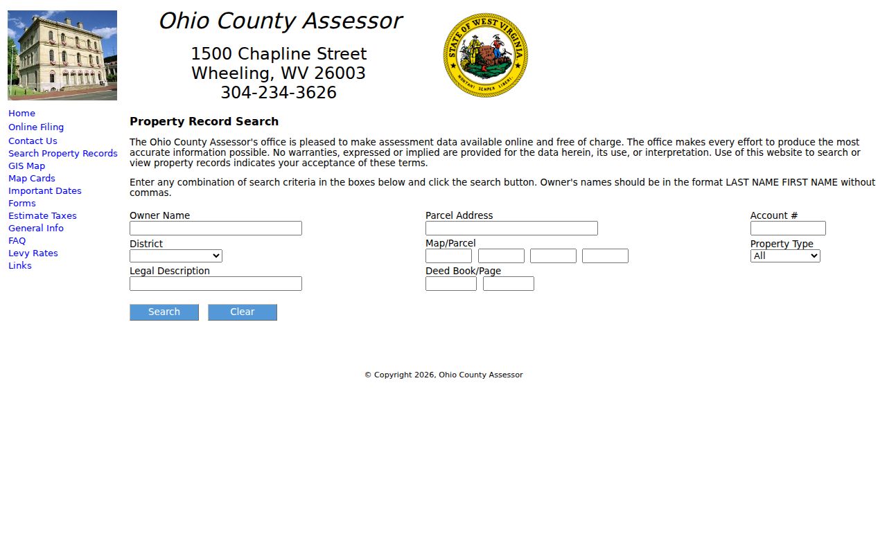
Match the form labels to the card fields. Then save the parcel key and deed reference for the next step.
Ohio County Deed Records Cross the 1993 Line
The Clerk's land-record system has two distinct search eras. Document Inquiry covers instruments recorded from January 1, 1993 forward. The historical Vault reaches from December 31, 1992 back to 1777. But it is not a modern address search. A user selects the Vault, chooses the book type, then enters book and page. When those numbers are unknown, the grantor or grantee index is the bridge.
| Record era | Search route | What to capture |
|---|---|---|
| 1993 to present | Document Inquiry | Party, role, type, recorded date and image reference. |
| 1777 to 1992 | Vault and index books | Book type, grantor/grantee, book and page. |
| Land tax books | Online Land Tax Books | Tax year and parcel context; the online series starts in 1884 and runs to ten years ago. |
Older deeds are indexed in three runs. The runs cover 1777 to 1935, 1936 to 1959, and 1960 to 1992. Each period keeps separate Grantor and Grantee books. Corporations and firms have an index of their own. Tracing a seller backward means starting with that seller as grantor. Finding how the current owner acquired land means searching for that owner as grantee. Verify the legal description on every result, not just the party name.
Modern summaries update when a document is recorded. The Clerk notes that the image takes roughly 28 business hours to appear. A missing image inside that window does not mean the document went unrecorded.
The Clerk's page describes the cutover. It also covers access routes (Ohio County Clerk online search FAQ).
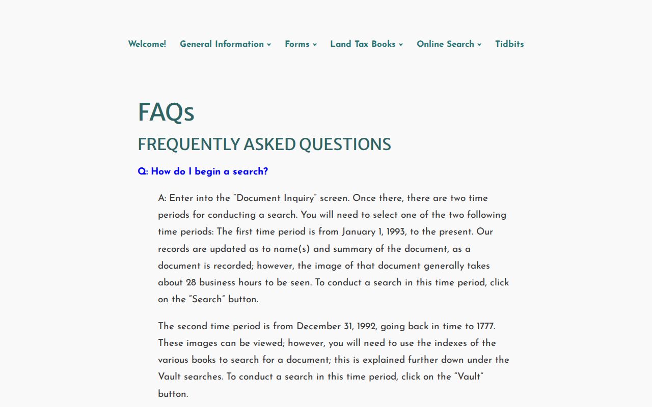
Let the notice separate the recorded index entry from the later image display. Keep the book and page for a counter request if one is needed.
Ohio County Property Records Serve Different Purposes
No single Ohio County record tells the whole story of a parcel. Deeds show the recorded transfer and legal description. The Assessor card organizes ownership and valuation for the tax roll, and the Sheriff search reports tax tickets and payment status. GIS layers draw a reference outline. City offices hold land-use and permit files. Match records by parcel and instrument reference before drawing any conclusion.
| Record Type | What It Documents | Kept By | Access |
|---|---|---|---|
| Deeds and deeds of trust | Transfers and secured interests of record. | Ohio County Clerk | Free index; paid online printing or in-person copies. |
| Liens and releases | Recorded claims and later releases or assignments. | Ohio County Clerk | Document Inquiry or historical Vault, by era. |
| Tax and assessment | Tax-roll identity, values, ticket and payment status. | Assessor and Sheriff | Separate public searches. |
| Plats and parcels | Lot context, parcel geometry and recorded maps. | Clerk, Assessor and WV Property Viewer | Map lines are reference geometry, not a survey. |
| Permits and zoning | Building, code, zoning and historic-review actions. | Relevant city office | Request from the municipal custodian; no verified field-level portal. |
For an ownership transfer, use the Ohio County deed index and inspect the instrument itself. For an assessment or bill question, compare the Assessor card with the Sheriff ticket. The same owner name can appear differently across these records, because an assessment roll, deed index and tax bill serve separate purposes.
Use the Ohio County Sheriff Search for Bills and Tickets
The Sheriff's tax inquiry stands apart from the Assessor's value search. Its fields cover taxpayer name in last-name-first form, account number, tax year, ticket and suffix, district, map and parcel, sub-parcel, Real or Personal property, and Paid or Unpaid status. Those keys help a researcher tell two tickets apart on one parcel, or pull a single tax year, without mistaking a payment result for a deed event.
Read each result with three items together: taxpayer, tax year, and ticket. A paid or unpaid label describes only that period's tax account. It says nothing about who took title, whether a lien remains, or whether a recent transfer has reached the roll. The Sheriff's tax office can be reached at 304-234-3688; the public search opens at ohio.softwaresystems.com.
Ohio County Land Tax Books offer a second, historical channel. The Clerk's online series runs from 1884 to ten years ago, and the most recent ten years point to WVPropertyTaxes. Older land-tax entries build a year-by-year trail, but they are tax records, not recorded conveyances. Keep them beside the deed chain rather than in place of it.
Ohio County Parcel Maps Are a Reference, Not a Survey
The WV Property Viewer takes several search inputs. It accepts an E-911 street address, parcel attributes, or a drawn geometry. A result can display a GIS ID, owner names, address, and a highlighted polygon. Detail pages add community data and flood information. They also add an assessment link, physical address, building information, and cost and appraised values. Tools include Highlight, Copy Link, KMZ download, CSV export, measurement, and drawing functions.
These tools help locate a parcel and compare it against the Assessor card. Limits apply. The viewer caps results at 1,000. Parcel boundaries appear only at close zoom. Tax-map lines are best-fit references. They do not define a legal boundary or replace a survey. Consult the recorded plat and deed description for lot shape and calls. Rely on a licensed surveyor for any boundary dispute. The statewide map explains its parcel view (WV Property Viewer).
Use the highlighted shape to orient your search. Then verify the parcel identifier against the county card and the recorded description before relying on the map.
Wheeling's 1873 Address Change Alters Old Searches
Wheeling changed its streets and street numbers on July 11, 1873. The date matters. A modern address may not appear in any deed, directory, or map made before the change. The building may still stand on the same ground. For an older property, the Ohio County Public Library offers help. Its old and new street-name handout serves as a crosswalk. Match its resulting lot or description to a Clerk record.
The library guide pairs maps from 1853, 1871, and 1901 with a 1918 Farmline map. The Farmline sheet records historic owners and boundaries outside downtown. Sanborn sheets add building footprints and hints of past use. Such sources link a modern parcel to an earlier urban lot. Still, the deed remains the title record. A directory entry names an occupant. It does not always name the owner. The Ohio County Public Library describes the full route. Its guide is Researching Historic Properties in Ohio County.
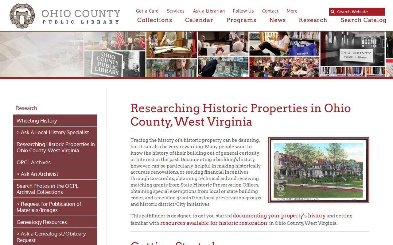
Keep both address forms in your notes. Label the source and date for each one. A labeled note keeps a later deed index search from mistaking a renumbered Wheeling street for a parcel that simply changed numbers in 1873, so your property records work stays on track.
Ohio County and City Records Answer Different Questions
Wheeling, Bethlehem and West Liberty keep no separate county assessors or recorders. Ohio County holds the deeds, the tax roll, and parcel ownership data. Municipal offices add permits, zoning decisions, code cases, public-way records, and historic review. A mailing label's postal city does not settle the municipal boundary. Wheeling and nearby unincorporated pockets make that distinction especially sharp.
Start with the county parcel and GIS map polygon for a city address. Then ask the city's planning or building custodian for permit material. Wheeling offers the documented 1873 address crosswalk and named historic districts. Bethlehem and West Liberty publish no subdivision lists, annexation chronologies, ZIP crossings, or public permit-search fields. Take those details from a municipal file. A recorded plat works as well, so avoid inferring boundaries from a postal address. The parcel number, not the mailing label, anchors a reliable property search.
Probate Papers Can Explain a Break in the Ohio County Deed Trail
An estate transfer rarely reads like a normal sale. The Ohio County Clerk indexes estate papers, appraisements, and settlements alongside the deed records. A fiduciary deed often shows how a personal representative conveyed a parcel of land. Wills sit in a strange middle ground here. One merely lodged after death gets indexed, but it stays out of view until probated. So when an Ohio County deed chain jumps from a deceased owner of record straight to a later buyer, check the estate record and hunt for a fiduciary or corrective instrument before assuming a deed book went missing.
Portals fail. Some skip whole years. The right fallback depends on the record you need. The Clerk's counter sits in Room 205 at 1500 Chapline Street, and the county asks visitors to arrange a visit by phone at 304-234-3656. For older material, the WV Archives finding aid lists Ohio County deed, trust-deed, survey, plat, court, will, tax, and lien holdings on microfilm. A public-record request aimed at another West Virginia custodian falls under the West Virginia Freedom of Information Act. Even so, an FOIA request never replaces the Clerk's own indexing process.
Ohio County offers no verified property-fraud alert signup. Unsolicited letters about your deed deserve suspicion. Note: Confirm any suspicious notice through the official county contact page, never a number printed on an unsolicited letter.
Limits of an Ohio County Property Record Search
Ohio County property records report only what their custodians keep. Indexes miss variant spellings. A new deed image may not be posted yet. Parcel maps show best-fit lines, not surveyed edges. The assessor's owner field can lag behind a transfer, and no single record certifies market value, clear title, or current occupancy.
Lawful use. Use public property records for ownership research, property due diligence, history and civic purposes. Do not use owner details to stalk, harass or harm anyone, and obtain title or boundary advice from the appropriate professional.